DRONES HELP MONITORING OF FOEF PAST AND NEW PROJECTS
Briefing Report: 1-5-2018
Friends of the East Fork monitors its stream and fish habitat projects for several years to see how they are performing and what results occurred after being in place over time. Our projects team is a trained and experienced mix of both non-professional and professional technical skills mix. The monitoring data is developed from a combination of both ground and air acquired information. What has been added to the process recently is the use of “drones”.
Pre-Construction
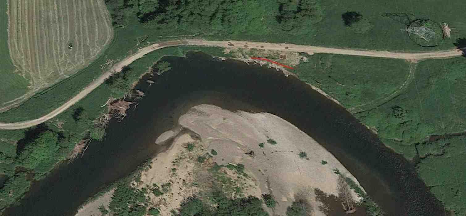
Swanson – Powerline Bend Project Site Google Aerial Photo: 5-22-2017
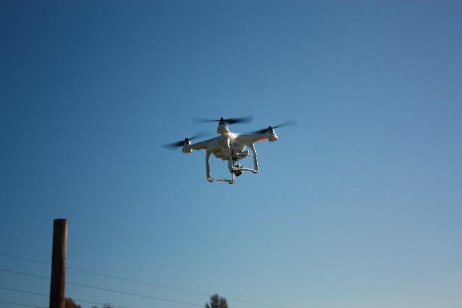
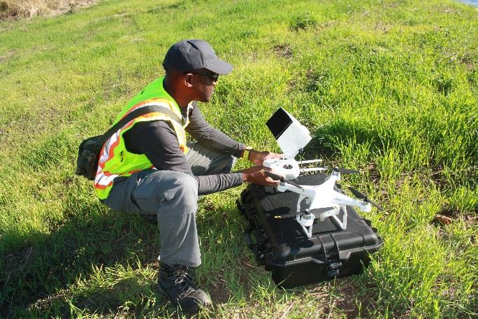
DJI Phantom-3 Pro Drone and Licensed Pilot
Drones allow us to monitor projects and river areas under different seasons of the year as well as a wide range of conditions, including heavy flooding periods when project components and the project stream reach is exposed to high levels of bank shear stress.
Multi-year and multi-season monitoring is critical to not only doing required monitoring of existing projects but also to achieve better planning and design of future projects. Drone photos can be taken at 400 ft. altitude (or higher), to as low as 5 ft. above the stream or ground surface.
The recent use of volunteer licensed drone pilots and their drones to fly the new Swanson-Powerline Bend Project is proving to be an important step in providing new and timely data and information on past and current projects. This is equally important for other areas of the river that need to be observed to see how they are functioning and affecting downstream areas during both low and high flow seasons.
Drone Air Photos of Project Treatments at Various Heights on Dec. 28, 2017:
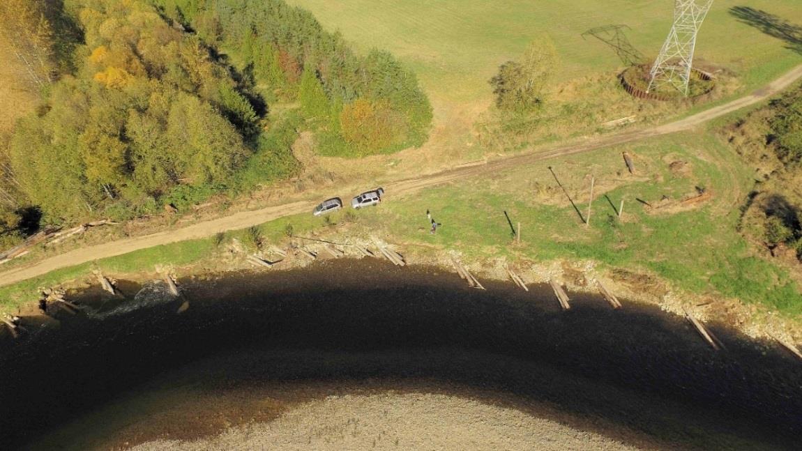
High Height
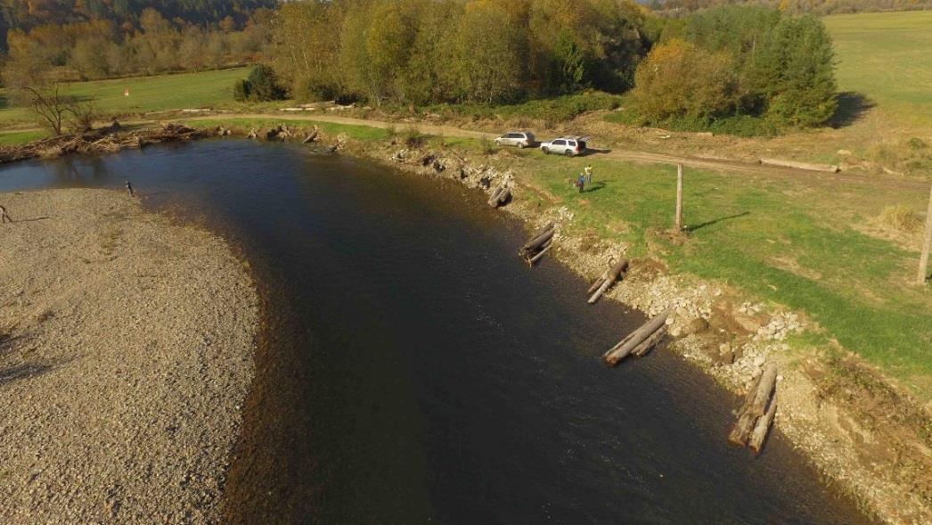
Medium Height
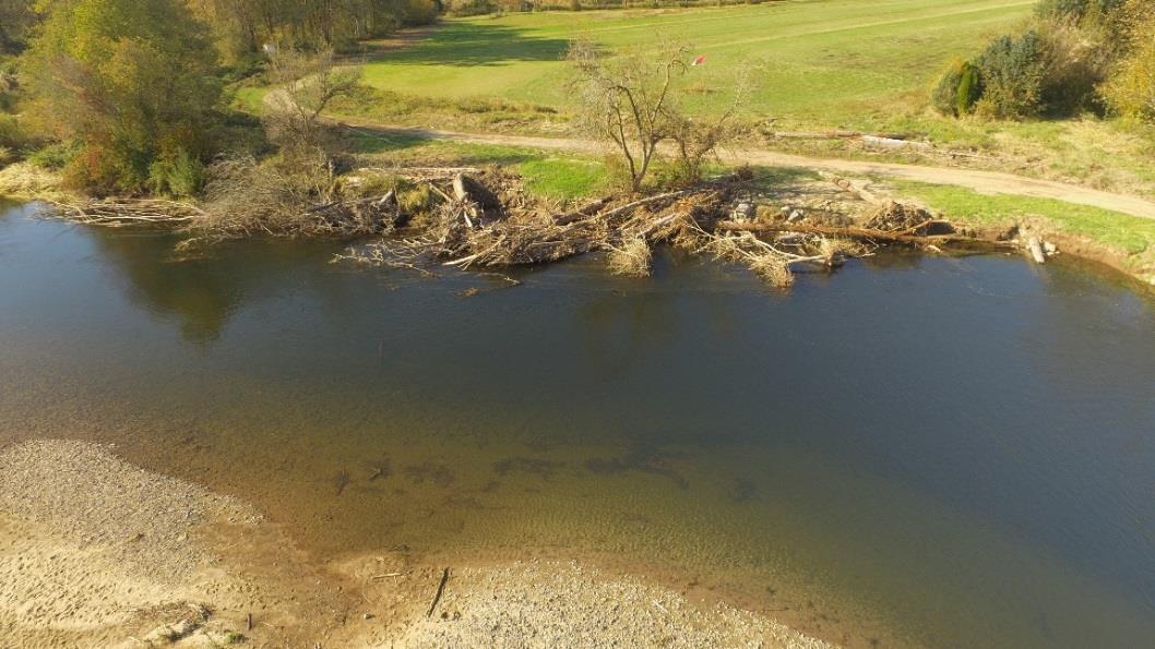
Medium Height
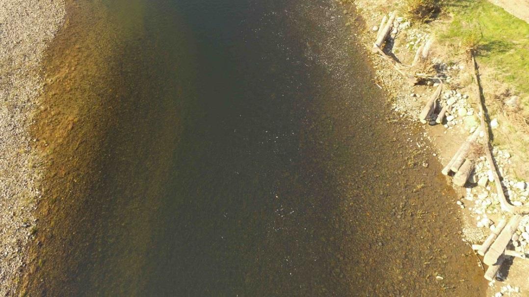
Low Height
Linking this new type of low altitude data and information to the ground information our field team has observed and gathered, allows us to be more effective in developing priorities.
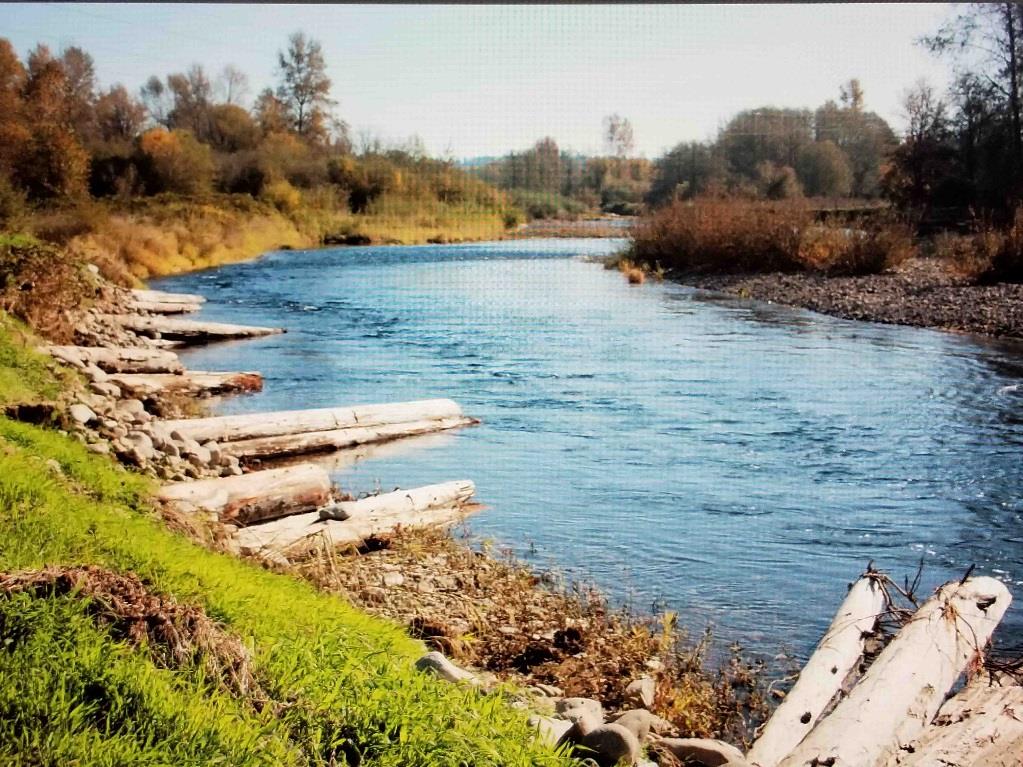
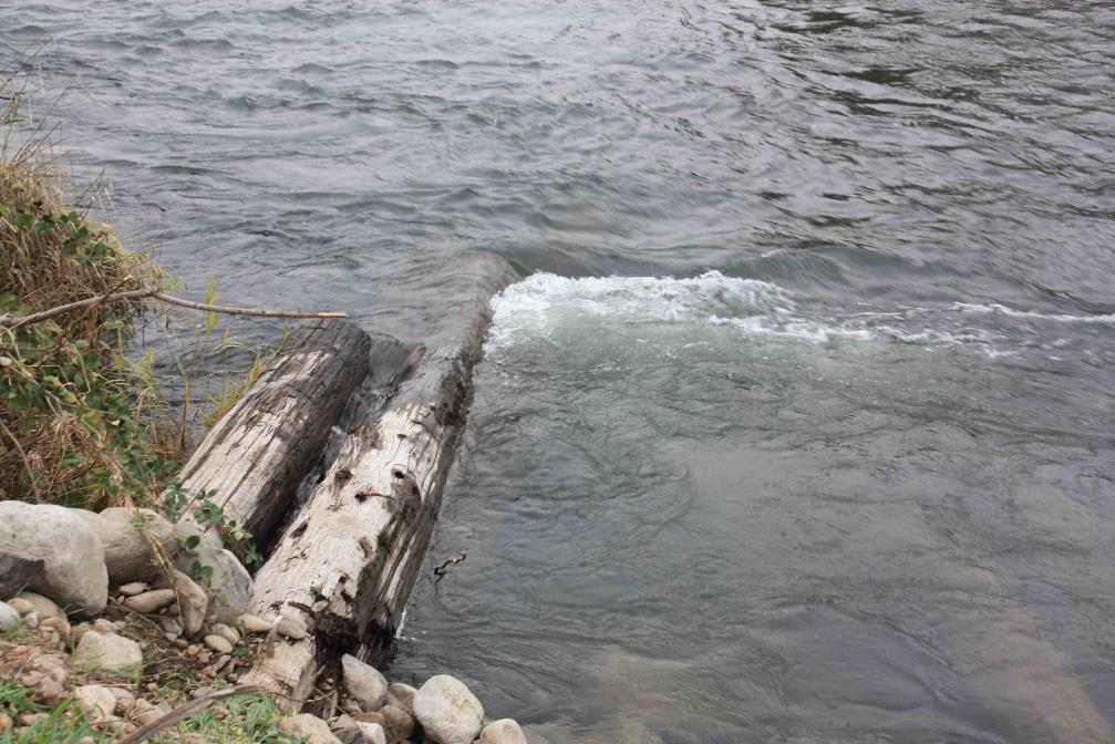
Ground Photos of Key Sections of the 650 FT. of Project Treatments:
Stacked Log Complexes During Flooding Conditions
Impacts from bedload sediment as well as suspended sediment are of particular concern in the lower East Fork. The 2010 fluvial-geomorphic study and report by Dr. Frank Reckendorf describes the lower East Fork very bedload sedimentation problems in detail. NO PROJECTS ON THE EAST FORK SHOULD BE DESIGNED WITHOUT PROPER FLUVIAL-GEOMORPHIC ANALYSIS OF SEDIMENT SOURCES AND TRANSPORT.
Analysis of historical aerial photos dating back to the 1930’s coupled with drone flight videos and photos provide valuable historical and up-to-date information for stream condition assessments and project priorities.
Drones can take both high quality video and still photos at the same time. They can also be setup with temperature imaging cameras to determine where the “hot spots” are in the river during summer low flow. And as previously mentioned, valuable information is obtained about sediment sources that shows where the sediment is depositing downstream and impacting both spawning areas, fish holding pools, and fish rearing areas. The Society for Ecological Restoration in 2014 concluded that geomorphic analysis of stream bedload is critical to effective treatment of degraded streams no matter what mix of materials are used.
Adding drone technology offers an opportunity to improve both cost management and design of long-term stream and fish habitat restoration programs and project efforts on the East Fork.
HOWEVER, NO MATTER HOW GOOD OR NEW THE TECHNOLOGY IS, TEAMWORK AND MENTORING ARE A KEY PART OF SUCCESS!
References:
Reckendorf, Frank PhD. 2010, Fluvial Geomorphology and Erosion and Sedimentation – East Fork Lewis River (RM 13 to RM 6) Including West Daybreak Park Project Reach, Reckendorf and Associates, Salem, Oregon.
Society for Ecological Restoration, 2014. Summary of Presentations. Redmond OR, Oct 6-10.